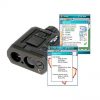
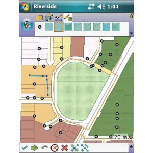
Laser Technology’s LaserGIS version 1.0.1 for ArcPad has been just been released. LaserGIS is a toolbar extension which streamlines the current ArcPad workflow for field data collection. This is done by expediting the set up process, eliminating menu clicks and better managing how you are going to collect and log your next feature. Since LaserGIS is built on ArcPad’s platform, any current user will learn quickly how it works and understand how useful this robust toolbar can be. Taking measurements and mapping with a TruPulse 360 laser offers its own benefits that will pay for itself with the first project. LaserGIS bridges the gap and feeds all the necessary laser data right into ArcPad seamlessly.

Related products
-
 GPS/GIS Software
Solo360 for ArcGIS
-
 GPS/GIS Software
ArcPad 10
-
 GPS/GIS Software
GeoJot+
-
 GPS/GIS Software
Terrain Navigator Pro