• Skip to main content
  • Skip to footer

Landmark Spatial Solutions

  • Home
  • Solutions
    • GPS Data Collection
    • GPS Field Software
    • GIS Software
    • Forest Inventory Software
    • Cruising Tools
    • Drones & UAVs
    • Laser Offsets
    • Log & Stockpile Inventory
    • Logging Solutions
    • Tree Positioning
  • Support
    • Software Downloads
    • Videos
    • Repairs
    • Training Manuals
    • Troubleshooting
    • Software Registration Forms
    • Support Contact
  • Training
    • Training Classes Overview
    • Calendar
    • Class Registration
  • Services
    • Consulting Services
    • Rental Units
    • Stockpile Measurements
  • Shop
    • My Account
    • Checkout
    • Cart
    • Handhelds
    • Cruising Tools
    • GPS/GIS Software
    • GPS Receivers
    • Forest Inventory Software
    • UAVs
  • News/Events
    • News
    • Upcoming Events
    • Newsletters
  • About Us
    • Our Team
    • Contact
    • Business Partners
  • Faith in the Forest
    • The Gospel of Jesus Christ
    • Importance of the Word
    • How to Grow Spiritually

November 23, 2016 By Johnny Thompson

Terrain Navigator Pro

We are pleased to partner with Trimble Forestry to offer you a Free Seven Day Trial to Terrain Navigator Pro – the award-winning mapping software widely used by foresters throughout the U.S. Try it free today!

TNP_LogoStart mapping in minutes – TNP makes mapping easy!

Terrain Navigator Pro is a robust mapping platform combining built-in topographic maps and aerial photos with easy-to-use mapping tools.

  • Includes topographic, aerial, satellite, and street maps of the United States –  all accessible “off the grid”
  • Add labels, marks, symbols, lines and routes to your maps
  • Measure areas and distances
  • Track colleagues and share data in near-real-time
  • Save projects to the cloud
  • Print professional quality, true-to-scale maps of any size
  • Export/Import maps in popular formats
  • Add private property lines, landowner names and parcel numbers*
Try it free


TNP_1

Private Land Ownership for TNP Desktop

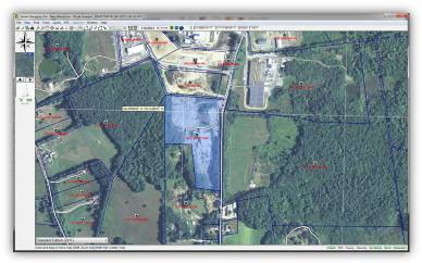
Parcel Data on the Desktop

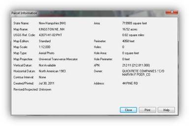
Terrain Navigator Pro now contains the option to show parcel boundaries on the desktop as part of a yearly parcel data subscription. The yearly parcel data subscription includes private land ownership details such as:

  • Private land boundaries polygons
  • The landowner’s name and address*
  • Assessor’s parcel number (APN)

TNP_2

Primary features at a glance

  • Find/Search Parcel
  • Parcel to Track
  • Parcel to Polygon
  • Parcel to Route
  • Parcel Centroid to Marker
  • Send Parcel to GPS (as track)
  • Send Parcel to GPS (as route)
  • Send Parcel Centroid to GPS (as mark)
  • Tracks, Routes, and Markers automatically sync to TNP mobile projects
TNP_3
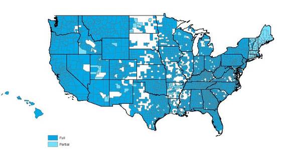
Parcel Data Availability

Filed Under: Uncategorized

Footer

For More Information Call:
866-395-5440

  • Johnny Thompson – Sales
  • Darian Yawn – Support
  • Steven Stuart – 4Loads/CFX/CFB

Connect with us!

  • Email
  • Facebook
  • LinkedIn
  • YouTube
Psalm 1:1-3 How blessed is the man who does not walk in the counsel of the wicked, Nor stand in the path of sinners, Nor sit in the seat of scoffers! But his delight is in the law of the Lord, And in His law he meditates day and night. He will be like a tree firmly planted by streams of water, Which yields its fruit in its season And its leaf does not wither; And in whatever he does, he prospers.

Copyright © 2019 · Landmark Spatial Solutions · All Rights Reserved · Developed by FGen Solutions · Log in