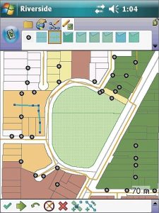
 ArcPad 10 is a mobile field mapping and data collection software designed for GIS professionals. It includes advanced GIS and GPS capabilities for capturing, editing, and displaying geographic information quickly and efficiently. Critical data can be checked in and out of a multi-user or personal geodatabase and shared across your organization.
- Collect accurate, reliable and validated field data
- Maintain a more accurate and up to date GIS database
- Increase GIS data collection productivity
- Incorporate GPS, laser rangefinders and digital photos into GIS data