Juniper Systems – Uinta


Juniper Systems’ Unita Mapping and Form Data Collection Software is simple, yet highly customizable. Uinta allows you to create your own point, line, and polygon mapping features that can be shared and exported in a variety of industry standard formats. Basemaps can be streamed or saved for offline use. Professional and simple all in the same package. Users rarely need more than an hour of web-based training. Works with Windows tablets, iOS, and Android devices.
Key Features:
- Customizable templates and icons
- Export data as a KML, PDF, Excel, .CSV, Shapefile, CAD (.dxf)
- Collect points, lines, polygons, and attribute data
- Compatible with Windows, Android, and iOS devices
- Use up to 2 devices per license
- Share projects with your team
- Great for a wide variety of industries
- App development is driven by customer feedback
- Easily pair with Juniper GNSS devices such as Geode, Spire, or the Archer4 GNSS pod

Want to engage with Esri technology in the field? ArcGIS Field Maps is an all-in-one app to help fieldworkers perform mobile data collection, edit features and attributes, find assets, and report their real-time locations. The app streamlines the critical workflows field personnel use every day. Field Maps sync seamlessly with other Esri platforms such as ArcGIS Pro, ArcGIS Online, Survey123, and more. This sync allows for better and faster sharing of critical data.
Key Features:
- Integrate with existing ArcGIS platforms such as ArcGIS Pro, ArcGIS Online, and Survey123
- Highly customizable
- Collect data on or offline
- Maps can be editable or view only
- Create To Do and task lists
- Share location with others
- Compatible with Android and iOS devices

In 2020, LMSS partnered with Woodland Solutions Group to provide our clients with MobileMap – an ESRI cloud-based inventory solution for Android devices. Timber cruising and mapping has never been easier! MobileMap simplifies your forest inventory workflow from planning to data delivery. With feature editing, efficient data collection, data validation, and improved project tracking, MobileMap contains everything you need to collect detailed forest inventory data!
Key Features:
- Navigate to plots
- Custom error checking
- Collect, edit, or digitize points, lines, and polygons
- Capture photos
- Cloud sycning to minimize file management
- Re-measuring or check cruising
- Compatible with Android 11 and newer devices
- Bluetooth compatible with LaserTech and Haglof devices


SOLO Forest
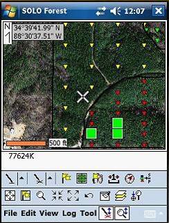
Trimble Forestry SOLO Forest software offers functionality and flexibility —all in a package. SOLO Forest lets you gather position and attribute data from Windows or Windows Mobile device. Best of all, SOLO Forest provides advanced features for advanced users while remaining easy to learn and operate.